1884 6 inch to the mile:
Whole parish A composite map made in photoshop; there are slight inaccuracies at map joins, parish boundary highlighted in red.
Individual map sheets
Click on a coloured rectangle on the map or chose from the list underneath the map. These are the original map sheets with full edging and information (used to build the composite map above).
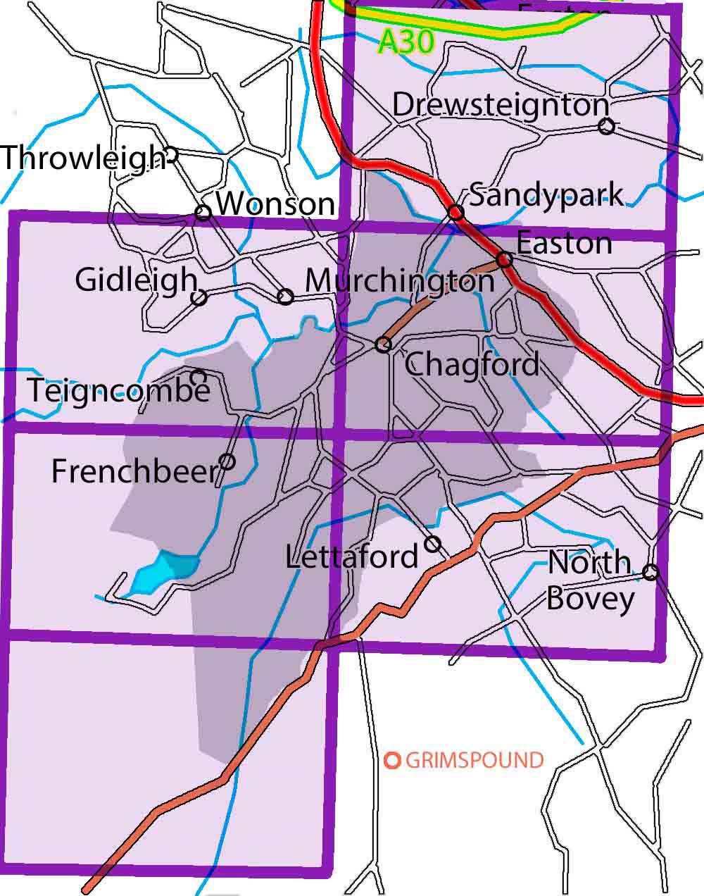
LXXVIII.SW: Rushford Wood, Drewsteignton
LXXXIX.NE: Thorn, Murchington, Gidleigh
XC.SW: Stiniel, Batworthy, North Bovey
XC.NW: Chagford Town, Easton
LXXXIX.SE: Hurston, Fernworthy
XCIX.NE: Chagford Common, Warren House Inn
- LXXVIII.SW / 78SW Rushford Wood, Drewsteignton
- LXXXIX.NE / 89NE Thorn, Murchington, Gidleigh
- XC.NW / 90NW Chagford Town, Easton
- LXXXIX.SE / 89SE Hurston, Fernworthy
- XC.SW / 90SW Stiniel, Batworthy, North Bovey
- XCIX.NE / 99NE Chagford Common, Warren House Inn
For help on how to use the zoomable maps: Instructions